Climate
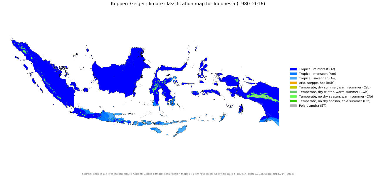
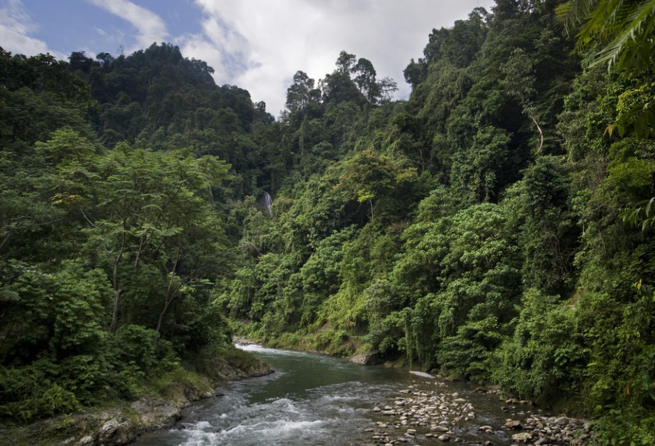
Indonesia lies along the equator, and its climate tends to be relatively even year-round. Indonesia has two seasons—a wet season and a dry season—with no extremes of summer or winter. For most of Indonesia, the dry season falls between May and October with the wet season between November and April. Indonesia's climate is almost entirely tropical, dominated by the tropical rainforest climate found in every large island of Indonesia. The tropical monsoon climate predominantly lies along Java's coastal north, Sulawesi's coastal south and east, and Bali, while the tropical savanna climate lies in isolated parts of Central Java, lowland East Java, coastal southern Papua and smaller islands to the east of Lombok. More cooling climate types do exist in mountainous regions that are 1,300 to 1,500 metres (4,300 to 4,900 feet) above sea level. The oceanic climate (Köppen Cfb) prevails in highland areas adjacent to rainforest climates, with reasonably uniform precipitation year-round. In highland areas near the tropical monsoon and tropical savanna climates, the subtropical highland climate (Köppen Cwb) is prevalent with a more pronounced dry season

Some regions, such as Kalimantan and Sumatra, experience only slight differences in rainfall and temperature between the seasons, whereas others, such as Nusa Tenggara, experience far more pronounced differences with droughts in the dry season, and floods in the wet. Rainfall is plentiful, particularly in West Sumatra, West Kalimantan, West Java, and Papua. Parts of Sulawesi and some islands closer to Australia, such as Sumba are drier. The almost uniformly warm waters that constitute 81% of Indonesia's area ensure that temperatures on land remain relatively constant. The coastal plains average 28 °C (82.4 °F), the inland and mountain areas, 26 °C (78.8 °F), and the higher mountain regions, 23 °C (73.4 °F). The area's relative humidity ranges between 70 and 90%. Winds are moderate and generally predictable, with monsoons usually blowing in from the south and east in June through October, and from the northwest in November through March. Typhoons and large scale storms pose little hazard to mariners in Indonesian waters; significant dangers come from swift currents in channels, such as the Lombok and Sape straits

Geology
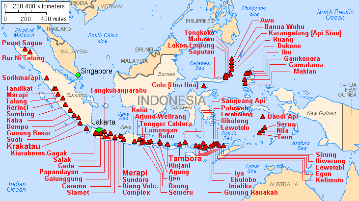
Tectonically, Indonesia is highly unstable, making it a site of numerous volcanoes and frequent earthquakes. It lies on the Pacific Ring of Fire where the Indo-Australian Plate and the Pacific Plate are pushed under the Eurasian plate where they melt at about 100 kilometres (62 miles) deep. A string of volcanoes runs through Sumatra, Java, Bali and Nusa Tenggara, and then to the Banda Islands of Maluku to northeastern Sulawesi. Of the 400 volcanoes, around 130 are active .Between 1972 and 1991, there were 29 volcanic eruptions, mostly on Java. Volcanic ash has made agricultural conditions unpredictable in some areas. However, it has also resulted in fertile soils, a factor in historically sustaining high population densities of Java and Bali
A massive supervolcano erupted at present-day Lake Toba around 70,000 BCE. It is believed to have caused a global volcanic winter and cooling of the climate, and subsequently led to a genetic bottleneck in human evolution, though this is still in debate. The 1815 eruption of Mount Tambora and the 1883 eruption of Krakatoa were among the largest in recorded history. The former caused 92,000 deaths and created an umbrella of volcanic ash which spread and blanketed parts of the archipelago, and made much of Northern Hemisphere without summer in 1816. The latter produced the loudest sound in recorded history and caused 36,000 deaths due to the eruption itself and the resulting tsunamis, with significant additional effects around the world years after the event. Recent catastrophic disasters due to seismic activity include the 2004 Indian Ocean earthquake and the 2006 Yogyakarta earthquake

 online precipitation